 GPS
GPS
A GPS (Global Positioning System) unit is a small electronic device that can calculate its current latitude and longitude and from that, most can display where you are on a map.
I used my brother’s unit and discovered I live at: Latitude N+48° 26’ 188”, Longitude W-123° 21’ 158”.
The electronics are so compact they can easily fit into a hand held unit, a cellphone, a lap top, an automobile, a boat, wrist-mounted compass etc. Some units have Bluetooth connectivity. Some have built-in maps of entire continents so they can display where you are or direct you to where you want to go by roads. Some speak. Some take voice input.
GPS is a navigation system that works by comparing the time signals from four or more satellites. From the time it takes each signal to reach the unit, it can compute the distance to each satellite. From the positions of the satellites it can then triangulate to compute the latitude and longitude of the unit. Even an inexpensive unit is accurate to within 3 metres (9.84 ft). What primarily determines accuracy is the number of satellites within line of sight.
If you are moving, the unit can compare your previous with your current position and hence tell which compass direction you are headed. They can also compute your speed. For moving computations, you want readings from as many satellites as possible.
Contrary to what you may have heard on a science channel on TV, GPS units are passive. They don’t broadcast anything to the satellites. If they did, the hand held units would need hugely more power and the satellites would need the processing power to simultaneously handle millions of conversations.
The satellite transmissions also let the unit calculate UTC time, which knowing your time zone from your latitude and longitude, it can convert into local time. This is non-trivial task. There are thousands of tiny timezones in the world, some as small as a city, each of which flip to and from DST on different days, sometimes by amounts more than an hour. Once you know your position, all you need thereafter is the signal from one satellite to synchronise the time.
The GPS scheme was originally developed by the US military for use in guiding weaponry. At first they hobbled its accuracy for civilian use to about 100 metres (109.36 yards), then in 2000 they dropped that on the understanding they might shut the system down at any time that they felt the GPS system might be used for military purposes against US interests. The military then built an even more accurate system strictly for military use.
APRS (Automatic Position Reporting System) reports your position by packet radio relayed to the Internet. This lets your friends and thieves know when you are home and where you are. Be careful, it is typically turned on by default. It could be used by a bus, taxi or shipping company to keep track of its vehicles and how long they stop.
If your GPS unit comes with this feature, make sure you learn how to turn it off.
Garmin is a GPS manufacturer that makes a bewildering array of GPS units. Most models differ from a sibling in only one minor detail. I am astounded they can make money carrying an inventory of so many tiny variations. They also sell many other kinds of personal electronics, usually with GPS thrown in.
There are models specialised for various types of vehicles, various sports, various types of trail use, including wrist mounted, in the air and even dog tracking. Specialised versions are more expensive but they typically have extra goodies like a geotagging camera, altimeter or text messaging.
Hikers, cross-country runners, tourists and others can use a GPS receiver to pinpoint their location and find their way from landmark to checkpoint and safely back home. A GPS can be used to mark a particular spot on the map so that you can return to that exact location later.
~ Mio
Spot is a two-way GPS service that sends your location to a satellite where it can be relayed to 911 emergency service or your friends. It costs for the unit and a month. They also make a device for tracking stolen property.
There are three ways the GPS unit has of figuring out which way is north and how to orient the map.
Most GPS units optionally display a north indicator on screen or have a north-up feature to always display the map with north at the top in which case you don’t need an indicator.
Here is a simple strategy to make your GPS work, to help you avoid overwhelm:
It is quite difficult to locate an address on the tiny maps inside a GPS unit. You must have a very good idea where the address is before you can find it on a map. Alternatively, you can use your desktop computer to look up the GPS co-ordinates (latitude and longitude) of the destination, (or find the address on a big detailed map) and enter them numerically into your GPS unit. You can use a service like:
There are three types of vehicle tracking:
Consider how costly a search is for a lost hiker or a skier lost out of bounds. It often puts the lives of searchers at risk. Finding the lost person often comes too late. It should be mandatory for hikers and out-of-bounds skiers to carry a GPS unit that digitally reports their position, so if they get in trouble, rescuers know exactly where to look.
You should be able to rent a Spot-3 unit for a a day. That is ridiculously small insurance.
A GPS latitude/longitude such as N+48° 26’ 188”, W-123° 21’ 158” is long, unwieldy, error prone and hard to remember. The people at what3words.com have come up with a system to encode GPS addresses as 3 words (in a choice of 11 languages), e.g. thing.alarm.isolated or index.home.raft, that is similar to the way PGP (Pretty Good Privacy) encodes hex fingerprints as a series of English words.
The word triple narrows the co-ordinates down to a 3 metres (9.84 ft) square. I don’t think they reuse words in a triple. Order within a triple matters.
GPSes are hampered by tiny screen and a lack of a keyboard. This could largely be ameliorated by providing shadow software to run on a PC (Personal Computer), laptop, or pad computer. You would use the keying ability and larger screen of this auxiliary computer to plan trips, label waypoints, download maps etc. The auxiliary computer would attach by USB (Universal Serial Bus), WiFi (Wireless Fidelity) or BlueTooth.
This way, you could use fully detailed maps with all minor streets labeled with street numbers. There would be plenty of CPU/RAM to compute routes.
Civic maps were largely created in the days where positions were determined by surveying. They often contain gross errors. These maps could be automatically corrected from automatically submitted GPS readings (especially from automobiles) and satellite photos. Prior to GPS, I was involved in a project to unify civic, phone company, gas company and electric utility maps. Typically those maps disagreed by 9.14 metres (10 yards). The key to unifying was to find common points on all maps, determine their accurate location, then mathematically warp the maps.
There is another technology for determining position, mathematically integrating an accelerometer. Perhaps eventually that could be combined with GPS and calibration (taking your GPS to a survey stake) to get position accurate to 50 cm (1.64 ft).
Orange is considered the official GPS colour, hence its popularity in GPS devices. It makes them easy to find if you lose them in dense bush.
$54.99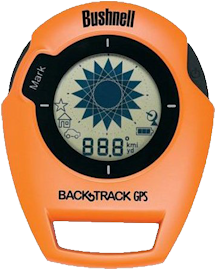 |
recommend electronic⇒Bushnell Back Track Original G2 Bk/Or | |||||||||||||||||||||||||||||||||||||||||||||
| asin | B006U3ZJAM | |||||||||||||||||||||||||||||||||||||||||||||
|---|---|---|---|---|---|---|---|---|---|---|---|---|---|---|---|---|---|---|---|---|---|---|---|---|---|---|---|---|---|---|---|---|---|---|---|---|---|---|---|---|---|---|---|---|---|---|
| dim | 7.49 × 8.99 × 1.90 cm 2.95 × 3.54 × 0¾ in | |||||||||||||||||||||||||||||||||||||||||||||
| This product is not in stock at any of the Amazon stores. This little unit contains a GPS receiver, but contains no maps and has only the most rudimentary screen. It runs off two AAA batteries. There are variants in dozens of shapes and colours, most more expensive. This model comes in black, orange and silver. What possible use is it? You put in on your keychain and when you park your car you press a button to tell the unit Remember this spot. Then later, when you want to find your car, you press another button and an arrow appears that keeps pointing at where your car is (or at the next intermediate point on the way to your car.) If you use it in the woods, it will guide you back to where you started your hike. You can use it any time you need to get back to some starting place. You could use at an exposition to find your way back to the entrance. You could use it to find your way back to your hotel in Japan. Its bigger brothers behave like hiking GPSes without the maps. Specs. | ||||||||||||||||||||||||||||||||||||||||||||||
| ||||||||||||||||||||||||||||||||||||||||||||||
| Greyed out stores probably do not have the item in stock | ||||||||||||||||||||||||||||||||||||||||||||||
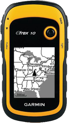 |
recommend electronic⇒Garmin eTrex 10 Worldwide Handheld GPS Navigator | |||||||||||||||||||||||||||||||||||||||||||||
| asin | B00542NV32 | |||||||||||||||||||||||||||||||||||||||||||||
|---|---|---|---|---|---|---|---|---|---|---|---|---|---|---|---|---|---|---|---|---|---|---|---|---|---|---|---|---|---|---|---|---|---|---|---|---|---|---|---|---|---|---|---|---|---|---|
| dim | 3.56 × 4.32 × 3.30 cm 1.40 × 1.70 × 1.30 in | |||||||||||||||||||||||||||||||||||||||||||||
| Monochrome. 25-hour battery life. Monochrome takes much less power than colour. Has a colour big brother model, the eTrex 20. Uses both GPS and GLONASS satellites. No compass. No camera. Takes 3-4 minutes to take a reading. Almost non-existent base map. No audible warning it is time to change batteries. Can download your readings into Google Earth. The big negative with this unit is you cannot use any other maps than the quite basic ones that come with it. It is quite thick. Specs. | ||||||||||||||||||||||||||||||||||||||||||||||
| ||||||||||||||||||||||||||||||||||||||||||||||
| Greyed out stores probably do not have the item in stock | ||||||||||||||||||||||||||||||||||||||||||||||
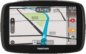 |
recommend electronic⇒TomTom GO 50 Portable Vehicle GPS | |||||||||||||||||||||||||||||||||||||||||||||
| asin | B00I9UKU8K | |||||||||||||||||||||||||||||||||||||||||||||
|---|---|---|---|---|---|---|---|---|---|---|---|---|---|---|---|---|---|---|---|---|---|---|---|---|---|---|---|---|---|---|---|---|---|---|---|---|---|---|---|---|---|---|---|---|---|---|
| dim | 14.45 × 9.05 × 2.38 cm 5.69 × 3.56 × 0.94 in | |||||||||||||||||||||||||||||||||||||||||||||
| This is TomTom’s basic model in their new line. It has lifetime maps of the USA, Canada and Mexico but not the rest of the world. It has 3D street maps showing building outlines. 2 hour battery, custom $19. Touch screen. Does not talk or accept voice commands. Mounting hardware is extra. You can get traffic reports if you connect a cellphone and if you pay an extra fee. Specs. | ||||||||||||||||||||||||||||||||||||||||||||||
| ||||||||||||||||||||||||||||||||||||||||||||||
| Greyed out stores probably do not have the item in stock | ||||||||||||||||||||||||||||||||||||||||||||||
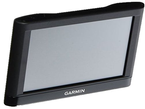 |
recommend electronic⇒Garmin nüvi 55LM GPS Navigator System ) | |||||||||||||||||||||||||||||||||||||||||||||
| asin | B00HEGP40E | |||||||||||||||||||||||||||||||||||||||||||||
|---|---|---|---|---|---|---|---|---|---|---|---|---|---|---|---|---|---|---|---|---|---|---|---|---|---|---|---|---|---|---|---|---|---|---|---|---|---|---|---|---|---|---|---|---|---|---|
| dim | 12.70 cm 5 in | |||||||||||||||||||||||||||||||||||||||||||||
| Spoken turn-by-turn directions. Preloaded maps. Speed limit displays (Lower 49 U.S. States). Also comes in 6" version. Lifetime map updates bundled. | ||||||||||||||||||||||||||||||||||||||||||||||
| ||||||||||||||||||||||||||||||||||||||||||||||
| Greyed out stores probably do not have the item in stock | ||||||||||||||||||||||||||||||||||||||||||||||
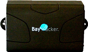 |
recommend electronic⇒GPS Tracking Device, BayTracker BT-2000 RealTime Spy Tracking Device | |||||||||||||||||||||||||||||||||||||||||||||
| asin | B00LWE49GO | |||||||||||||||||||||||||||||||||||||||||||||
|---|---|---|---|---|---|---|---|---|---|---|---|---|---|---|---|---|---|---|---|---|---|---|---|---|---|---|---|---|---|---|---|---|---|---|---|---|---|---|---|---|---|---|---|---|---|---|
| This device is not for navigating but for spying. It quite small — easy to conceal. You must set up a GSM/SIM data cellphone account for it and pay the monthly texting fees. It sends its position in periodically over the cellphone network. You could use it to locate your vehicle if it is stolen. You could use it to track where your teenage children drove and how fast. You could put it in a briefcase to track its whereabouts. You could use it to track the whereabouts of your pets, equipment, Alzheimer’s patients… It is battery powered, but it can also be hooked up to a car battery. It has a hidden microphone for covert operations. Basically it is a remote-controlled phone. 60-day standby battery. | ||||||||||||||||||||||||||||||||||||||||||||||
| ||||||||||||||||||||||||||||||||||||||||||||||
| Greyed out stores probably do not have the item in stock | ||||||||||||||||||||||||||||||||||||||||||||||
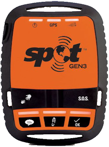 |
recommend electronic⇒SPOT 3 Satellite GPS Messenger - Orange | |||||||||||||||||||||||||||||||||||||||||||||
| asin | B00C8S8S4W | |||||||||||||||||||||||||||||||||||||||||||||
|---|---|---|---|---|---|---|---|---|---|---|---|---|---|---|---|---|---|---|---|---|---|---|---|---|---|---|---|---|---|---|---|---|---|---|---|---|---|---|---|---|---|---|---|---|---|---|
| dim | 6½ × 8.71 × 2.54 cm 2.56 × 3.43 × 1 in | |||||||||||||||||||||||||||||||||||||||||||||
| This unit is not for navigating, but for aiding rescue workers to find if you become disabled. So long as you are moving, it takes GPS readings every 2.5 to 60 minutes reporting where you are and sends them digitally via satellite. People back home can monitor your progress on your planned route. Even if you are unconscious, others can still find you. You need a satellite phone subscription that will cost you an additional $150 a year. You can also get it to send in an SOS to an emergency response center. You can also get it to send I’m-OK or other canned messages. It is not a satellite voice phone. It is not a satellite texting device. Battery life 5 days. 114 g 4.0 oz. Specs. manual. | ||||||||||||||||||||||||||||||||||||||||||||||
| ||||||||||||||||||||||||||||||||||||||||||||||
| Greyed out stores probably do not have the item in stock | ||||||||||||||||||||||||||||||||||||||||||||||
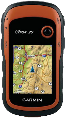 |
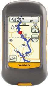
recommend electronic⇒Garmin eTrex 20 Worldwide Handheld GPS Navigator | |||||||||||||||||||||||||||||||||||||||||||||
| asin | B00542NVDW | |||||||||||||||||||||||||||||||||||||||||||||
|---|---|---|---|---|---|---|---|---|---|---|---|---|---|---|---|---|---|---|---|---|---|---|---|---|---|---|---|---|---|---|---|---|---|---|---|---|---|---|---|---|---|---|---|---|---|---|
| dim | 5.33 × 10.16 × 3.30 cm 2.10 × 4 × 1.30 in | |||||||||||||||||||||||||||||||||||||||||||||
| Colour. 25-hour battery life. 1.7 GB memory. Uses both GPS and GLONASS satellites. Has HotFix. Compass extra. No camera. Compatible with topographic, marine and road maps. However, it is not like an automotive unit showing you road routes and telling you where to turn. You cannot enter an address and have it direct you there. Sun and moon rise and set. This is Garmin’s best selling hiking model. Etrex Jitter is when a bit of vibration causes the GPS to turn itself off. Its caused by a momentary loss of power to the circuit board. There is a spring-loaded contact between the battery compartment and the board itself. It is not the sprung battery contacts, which are a good tight fit — this is a common misconception but the offending contact is deeper inside the casing and, crucially, inside the fully-waterproofed section, making it difficult to do an easy fix. As the GPS ages, the problem does seem to get a bit worse. Specs. manual. | ||||||||||||||||||||||||||||||||||||||||||||||
| ||||||||||||||||||||||||||||||||||||||||||||||
| Greyed out stores probably do not have the item in stock | ||||||||||||||||||||||||||||||||||||||||||||||
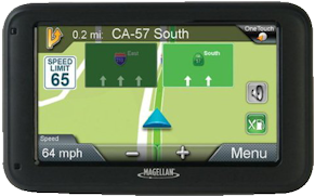 |
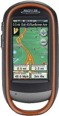
recommend electronic⇒Magellan RoadMate 5220-LM Portable GPS Navigator with Lifetime Maps | |||||||||||||||||||||||||||||||||||||||||||||
| asin | B0082XN4PA | |||||||||||||||||||||||||||||||||||||||||||||
|---|---|---|---|---|---|---|---|---|---|---|---|---|---|---|---|---|---|---|---|---|---|---|---|---|---|---|---|---|---|---|---|---|---|---|---|---|---|---|---|---|---|---|---|---|---|---|
| dim | 14.22 × 8.64 × 1½ cm 5.60 × 3.40 × 0.59 in | |||||||||||||||||||||||||||||||||||||||||||||
| This model is also sold as the 5202-LM which is newer but has identical specs. This is designed for cars. It has a 2-hour integrated lithium battery. It warns you about traffic cameras and speed limits. It helps you find parking. It comes with lifetime maps for North America only. Specs. If you shop around you can usually find auto GPS units deeply discounted. | ||||||||||||||||||||||||||||||||||||||||||||||
| ||||||||||||||||||||||||||||||||||||||||||||||
| Greyed out stores probably do not have the item in stock | ||||||||||||||||||||||||||||||||||||||||||||||
 |
recommend electronic⇒Magellan CX0310SGXNA eXplorist 310 Waterproof Hiking GPS | |||||||||||||||||||||||||||||||||||||||||||||
| asin | B004JU0E2G | |||||||||||||||||||||||||||||||||||||||||||||
|---|---|---|---|---|---|---|---|---|---|---|---|---|---|---|---|---|---|---|---|---|---|---|---|---|---|---|---|---|---|---|---|---|---|---|---|---|---|---|---|---|---|---|---|---|---|---|
| dim | 5.59 × 11.18 × 3.56 cm 2.20 × 4.40 × 1.40 in | |||||||||||||||||||||||||||||||||||||||||||||
Ruggedised, waterproof. 18 hour battery life. 2 GB. WAAS-enhanced. Comes with world maps. Can upload additional maps. Accuracy 3 to 5 meters. It will display your co-ordinates in many different formats. At a slight extra cost you can load satellite images into it too. Has no SD card for holding large maps. It also comes is various bundles with extra maps or software. Specs. catalog. Magellan Communicator. This is the unit I bought. It is smaller than it looks. I expected it to be thin like an iPad, but it is shaped more like a small potato. It is quite tough. Nearly all the space inside is used for two AA batteries. The type on the screen is microscopic, but clear. To get it started, you must turn a heavy duty thumbscrew on the back to remove the back, then insert two batteries. The on-off switch does not look like a switch, more like an embossed logo decoration on the top end of the case None of the software inside the unit would run on a PC. It said the exe files were not valid Win32 apps. I downloaded the communicator, but contained only DLLs, nothing to execute. By default, the screen backlight is extremely bright. I configured it dimmer. The control button/micro joystick in the middle can be tilted N W S E or pressed. The joystick is awkward to use. It often does the opposite of what I intended. There is an onscreen keyboard. I was unable to control it with the joystick. (The trick is to push the joystick purely from the side, no down component whatsoever.) I was unable to display a map even after reading the getting started book and fooling around for about an hour. The unit I bought had been returned. I think the previous owner had damaged the firmware. I decided to return it. London Drug offered me a replacement unit. It worked quite a bit better. It displays maps allowing you to zoom from continent to block. The more you zoom in, the more smaller streets show up, neatly labeled. It is quite a bit easier to read and navigate than Google Maps even though it has a tiny screen. You just tilt the joystick in the direction you want to go and press the zoom in and zoom out buttons. Unfortunately Windows still refuses to run any of the software that comes with it. When I first got it, it thought it was in Vancouver (perhaps where its previous owner lives). It took it several minutes to clue in to its actual location here in Victoria 113 km away. When I turned it off, it reverted to thinking it was in Vancouver. I was pleased to discover its maps had even my minor Wark Street in its memory. It has no street numbers on the maps. You cannot enter an address and have it guide you to it. You must find your destination on the map, so you must have a rough idea where the address is to start. The problem is, you don’t see the minor streets until you have zoomed almost to the block level. To find one, you must know where it is — a chicken and egg problem. Perhaps you could use it in conjunction with Google Maps or a gas station street map to program your destination. The 510 and 610 models have turn-by-turn guidance as an extra cost option. With the 710, it is built-in. Improvements I would like to see include:
| ||||||||||||||||||||||||||||||||||||||||||||||
| ||||||||||||||||||||||||||||||||||||||||||||||
| Greyed out stores probably do not have the item in stock | ||||||||||||||||||||||||||||||||||||||||||||||
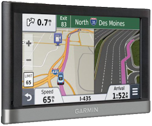 |
recommend electronic⇒Garmin nüvi 2577LT 5-Inch Bluetooth Portable Vehicle GPS with Lifetime Traffic | |||||||||||||||||||||||||||||||||||||||||||||
| asin | B00AXX0JNW | |||||||||||||||||||||||||||||||||||||||||||||
|---|---|---|---|---|---|---|---|---|---|---|---|---|---|---|---|---|---|---|---|---|---|---|---|---|---|---|---|---|---|---|---|---|---|---|---|---|---|---|---|---|---|---|---|---|---|---|
| dim | 13.72 × 8.38 × 1.93 cm 5.40 × 3.30 × 0.76 in | |||||||||||||||||||||||||||||||||||||||||||||
| The key feature of this unit is that you talk to it to give it commands. You don’t have to take your hands off the wheel. It talks back to you as well as showing directions on screen. It gives you traffic alerts — warning of congestion which arrive in real time by radio. To activate it, you need a $70 digital receiver. 2-hour battery life. The custom rechargeable battery costs $30. PhotoReal and Bird’s Eye junction views offer detailed images of junctions along your route, to ease the stress of merging on or off a roadway Specs. manual. This unit is very similar to the 2525LMT model. | ||||||||||||||||||||||||||||||||||||||||||||||
| ||||||||||||||||||||||||||||||||||||||||||||||
| Greyed out stores probably do not have the item in stock | ||||||||||||||||||||||||||||||||||||||||||||||
 |
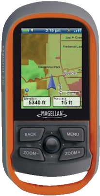
recommend electronic⇒Garmin Dakota 10 Waterproof Hiking GPS | |||||||||||||||||||||||||||||||||||||||||||||
| asin | B002G1YPIE | |||||||||||||||||||||||||||||||||||||||||||||
|---|---|---|---|---|---|---|---|---|---|---|---|---|---|---|---|---|---|---|---|---|---|---|---|---|---|---|---|---|---|---|---|---|---|---|---|---|---|---|---|---|---|---|---|---|---|---|
| dim | 3.63 × 5.46 cm 1.43 × 2.15 in | |||||||||||||||||||||||||||||||||||||||||||||
| This unit is specialised for hiking. It has topographical maps. It is rugged and waterproof. Its battery lasts for 20 hours. USB interface for downloading maps. Has sun/moon/tide tables. It floats. No compass. No camera. Specs. manual. | ||||||||||||||||||||||||||||||||||||||||||||||
| ||||||||||||||||||||||||||||||||||||||||||||||
| Greyed out stores probably do not have the item in stock | ||||||||||||||||||||||||||||||||||||||||||||||
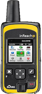 |
recommend electronic⇒DeLorme AG-009871-201 inReach SE | |||||||||||||||||||||||||||||||||||||||||||||
| asin | B00BX7TJ2O | |||||||||||||||||||||||||||||||||||||||||||||
|---|---|---|---|---|---|---|---|---|---|---|---|---|---|---|---|---|---|---|---|---|---|---|---|---|---|---|---|---|---|---|---|---|---|---|---|---|---|---|---|---|---|---|---|---|---|---|
| dim | 6.20 × 2.60 × 14.70 cm 2.44 × 1.02 × 5.79 in | |||||||||||||||||||||||||||||||||||||||||||||
| This unit is for people who are going into the backcountry where there is no cellphone coverage. In event of an accident, they want to be able to call for help and tell the rescuers exactly where they are. It can communicate via satellite sending text messages, but not voice. It is also a hiking GPS. 100 hour battery life. Accuracy within 5 meters. Must have a satellite phone subscription. Includes digital compass, barometric altimeter and accelerometer. No GLONASS. Specs. | ||||||||||||||||||||||||||||||||||||||||||||||
| ||||||||||||||||||||||||||||||||||||||||||||||
| Greyed out stores probably do not have the item in stock | ||||||||||||||||||||||||||||||||||||||||||||||
 |
recommend electronic⇒Magellan eXplorist 710 Waterproof Hiking GPS | |||||||||||||||||||||||||||||||||||||||||||||
| asin | B003XU78PE | |||||||||||||||||||||||||||||||||||||||||||||
|---|---|---|---|---|---|---|---|---|---|---|---|---|---|---|---|---|---|---|---|---|---|---|---|---|---|---|---|---|---|---|---|---|---|---|---|---|---|---|---|---|---|---|---|---|---|---|
| dim | 3.56 × 6.60 × 12.70 cm 1.40 × 2.60 × 5 in | |||||||||||||||||||||||||||||||||||||||||||||
| This is the top of the eXplorist line. The extra features reduce the battery life to 15 hours. Ruggedised, waterproof. Includes camera, voice recorder, speaker. It has no ability to communicate either via cellphone or satellite. Barometric altimeter and three-axis electronic compass. 500MB space on the internal memory for user storage of extra maps. It will guide you turn by turn on a route through a city. | ||||||||||||||||||||||||||||||||||||||||||||||
| ||||||||||||||||||||||||||||||||||||||||||||||
| Greyed out stores probably do not have the item in stock | ||||||||||||||||||||||||||||||||||||||||||||||
This page is posted |
http://mindprod.com/bgloss/gps.html | |
Optional Replicator mirror
|
J:\mindprod\bgloss\gps.html | |
Please read the feedback from other visitors,
or send your own feedback about the site. Contact Roedy. Please feel free to link to this page without explicit permission. | ||
| Canadian
Mind
Products
IP:[65.110.21.43] Your face IP:[216.73.217.43] |
| |
| Feedback |
You are visitor number | |